Select a region


The past three decades have brought many outlandish suggestions for revamping the 'Waterfront', ranging from adding a Magistrate's Court and church to creating a luxury new marina stretching to Havre des Pas...
But, by and large, the common themes have remained the same: housing, public spaces, links between the Waterfront and town... sound familiar?
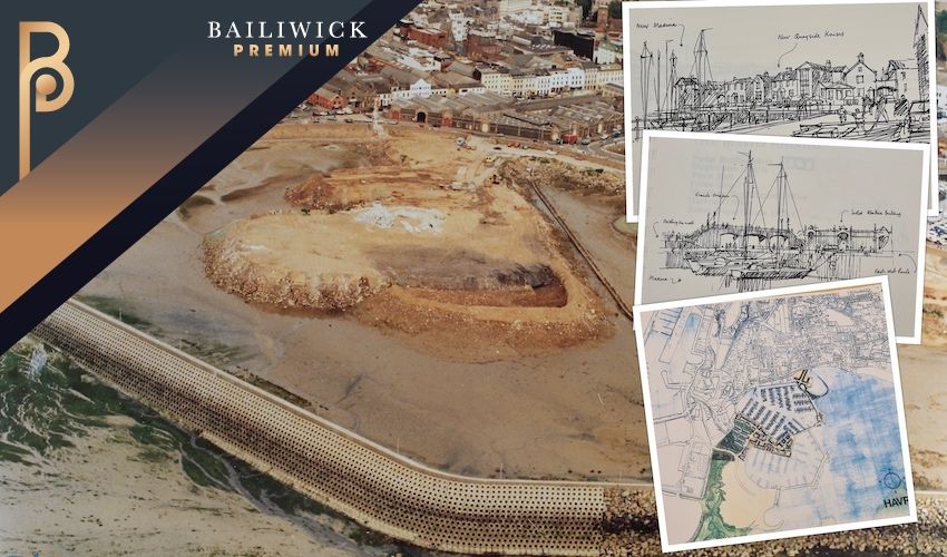
The Jersey Development Company recently put forward its plans for an ambitious redevelopment of the Waterfront, which include 1,000 units of accommodation, offices, shops, restaurants and a new leisure complex.
From the actual proposals to the wording used, reading the latest iteration of plans to regenerate the Waterfront area sparks a bit of a déjà vu.
Express dug into Jersey Archive's records and found out why...
Pictured: There were once talks of a Magistrate's Court on the Waterfront. (Jersey Heritage)
In the late 1980s, a number of “emergent issues” signalled the need for a “comprehensive development plan” for the Waterfront area, which at the time was defined as spanning from West Park to the Dicq.
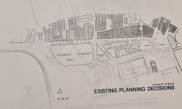
In 1988, the States Assembly approved a number of decisions including the creation of an underground multi-deck car park for up to 1,500 vehicles on the reclamation site, with a new Post and Administration office, States loan or rental housing and hospital staff accommodation above it, and the location of a new Magistrate’s Court, where Liberation House is now situated.
Several of the decisions were rescinded the following year, however.
In 1990, the Island Development Committee appointed the Waterfront Advisory Group, chaired by London architect William Whitfield, to produce a planning brief.
The document referred to various needs the plans would need to address, such as the protection of Elizabeth Castle’s surroundings, additional land reclamation in the area, “substantial provision” of new housing development, public open spaces and safe pedestrian movement as well as “adequate provision” for the future commercial and operational requirements of the Harbour and the conservation of the granite buildings on the “Weighbridge Island” site and the New North Quay.
Pictured: New North Quay was one of the areas that required "special consideration". (Jersey Heritage)
The Waterfront Plan put forward by Mr Whitfield sought to “describe the character and form of each part of the area and make proposals for the development, enhancement and reinforcement”.
He noted how the island was at a “crossroads”, with the 1986 census having shown the target of 80,000 people had been exceeded.
Mr Whitfield wrote that St. Helier had never been a “seaside town in the tradition of Regency and Victorian seaside resorts of the UK”, but instead showed a “working face” to the harbour.
He said the creation of “extensive areas” of land and the obsolescence of certain parts of the harbour presented an opportunity to “bring the town into contact with its waterfront in a way that created an interesting place for tourists and residents”.
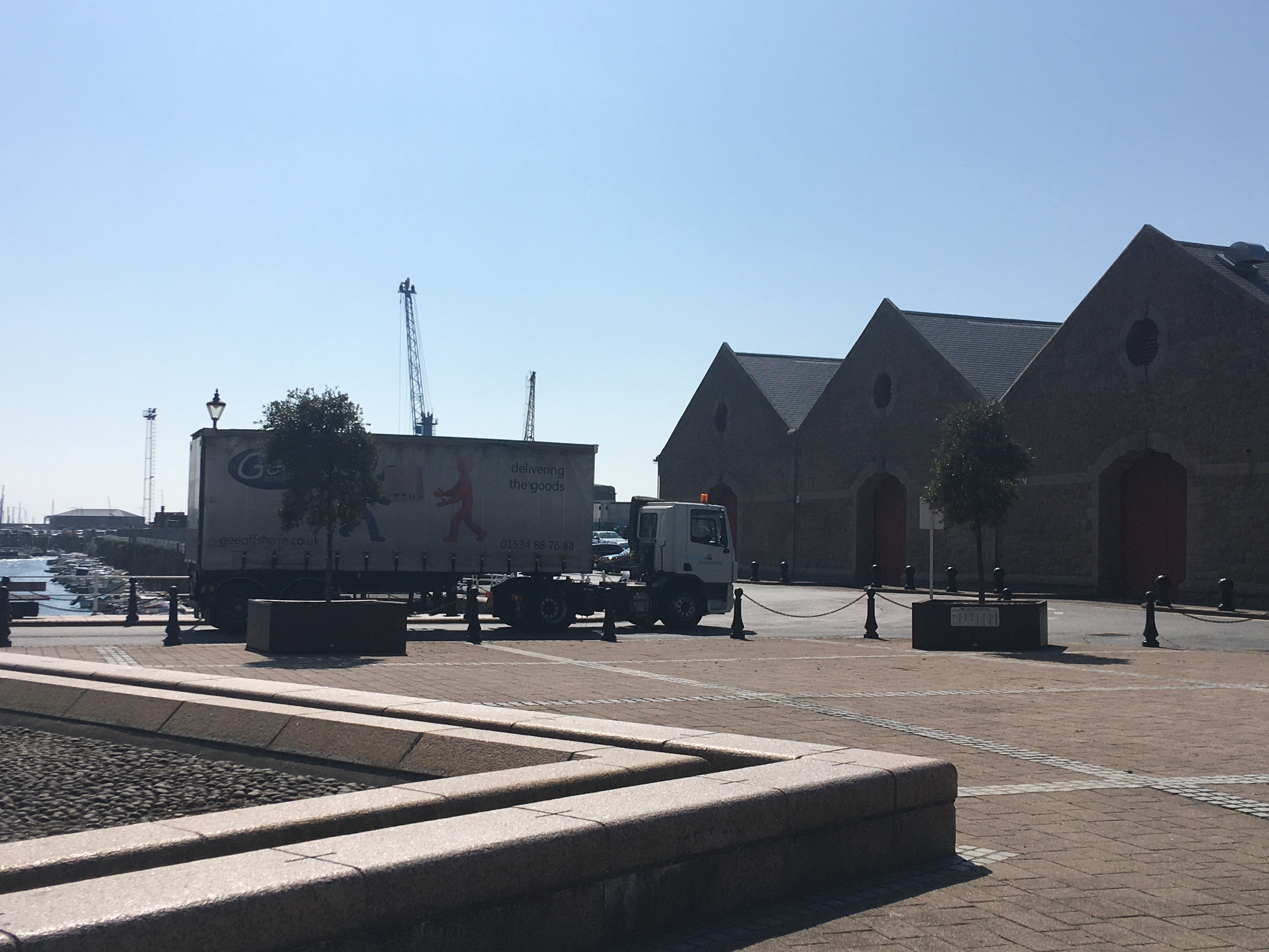
He said areas such as the disused Abattoir building (now Liberty Wharf) and the Weighbridge, the granite warehouses on New North Quay, La Folie, Commercial Buildings, among others required “special consideration”.
He suggested the creation of a Maritime Museum at La Folie, with the entrance, located behind the pub, leading into an exhibition yard and open workshops, for boat building, repairs as well as sail and block making.
His plans also included a café with a terrace leading on to the harbour where boats would be on display.
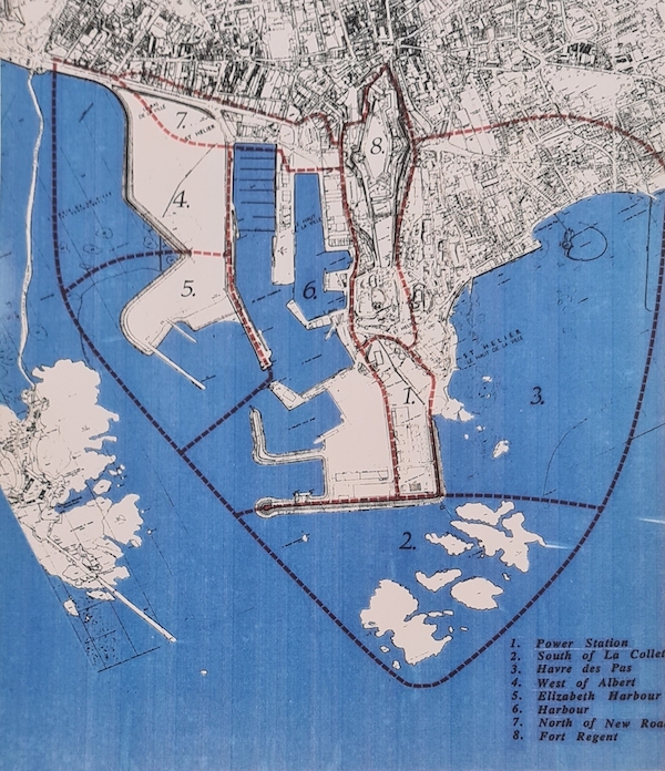
Pictured: The areas of the Waterfront. (Jersey Heritage)
The States adopted the underlying principles of the Planning Brief, following 84 submissions from consultants, in early 1990.
A consortium, led by architectural firm Andrew Downie and Partners, was then tasked with preparing a development plan.
Delivered in the spring of 1991, the plan warned there was a “danger of irrevocable damage” if things were allowed to happen by default or without concern for their relationship to other activities.
“What happened at the southern face of St. Helier demonstrates the results of expediency and ad hoc decision making in periods of rapid change,” the architects wrote.
They made proposals for each of the seven areas of the Waterfront, which they said would be “realistically achievable” before the end of the decade, as well as recommending the area to contribute towards the new public housing supply from 1995 to 2005. With 2,900 units needed in that time and a density of about 70 habitable rooms per acre, they estimated the area could provide between 200 and 240 units on a site at the west of Albert Pier.
The architects suggested saving 16.5 acres for the operational requirements of the harbour as well as the creation of two new warehouses of 20,000 square feet each and 3.2 acres for a trailer parking which would accommodate 300 trailers.
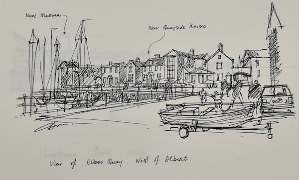
Pictured: The proposed quayside houses at the west of Albert Pier. (Jersey Heritage)
The west of Albert Pier would have been “the heart of the new community” centred around a quayside harbour of 400 yacht berths.
The proposals for that area included 8.6 hectares for homes, with an average density of 100 habitable rooms per acre. and 1.7 for a “high quality” mix of commercial use with green spaces.
They suggested extending the seaward site of the Esplanade walk to the south with a public promenade and creating a new town beach.
Half of the total area, the architects said, should be taken up by community facilities, including a school, public open space, and a church.
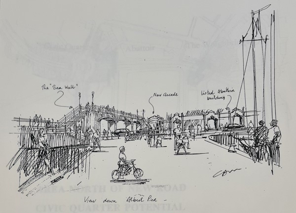
Pictured: A view down Albert Pier.
The architects suggested creating a new “civic quarter” around a new roundabout with new buildings creating a “well-defined urban space” at what was described as a “major entrance” to St. Helier both from west and east.
They proposed the extension of the old sea wall across the new road for pedestrian access, to link to a network of foot paths through the “revitalised” abattoir site and the new bus station.
The plans also included removing cars between the Weighbridge and Caledonia place to create a “well-defined public space with a major pedestrian amphitheatre beneath the new east to west route” that would link the town and the Maritime Museum directly through the historic quayside.
An over-bridge and a sunken piazza were also suggested to allow pedestrians to move easily from town to the marina.
With the creation of a new road passing at ground level behind Commercial Buildings, they hoped to regenerate the quayside and historic buildings and make Quai des Marchands traffic-free.
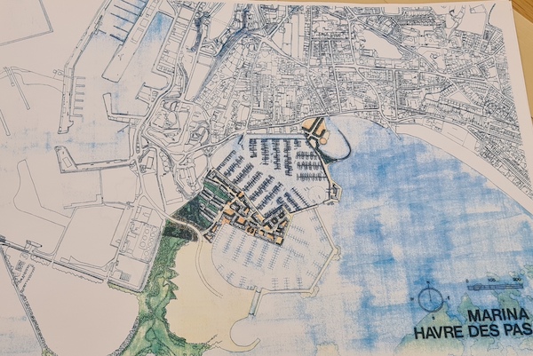
Pictured: The architects called for a new marina in Havre des Pas. (Jersey Heritage)
The architects also called for more land reclamation to the south and east of La Collette.
They suggested this would allow the creation of a new quayside at the south end of Havre des pas, as well as 5.5 hectares for residential and tourist development.
A 750-berth marina, extending to the swimming pool at the Lido, also featured on the plans, with islands within it creating a further two hectares for possible residential’ development.
In November 1991, the Finance and Economics Committees said they welcomed the concept but were reluctant to support “detailed plans for 25 years ahead” because the financial circumstances of the island may change over that period.
Pictured: A rendition of David Crossland's plans for the Waterfront. (Jersey Heritage)
Fast forward more than 20 years and another vision was laid out... In 2005, Airtours Founder David Crossland put forward his vision for the unused land at the Waterfront next to Jardins de la Mer.
This included 80 first class self-catering one or two-bedroom apartments, 80 one and two-bedroom apartments with “breath-taking views” over Elizabeth Castle and St. Aubin’s Bay, a health spa as well as an indoor pool and gym and an indoor children’s play area and restaurant.
All of this would have been set among an “horticultural extravaganza, meticulously entwined with waterfalls, natural stones and Jersey heritage trail” with the gardens’ design inspired by the world famous Getty Gardens in California.
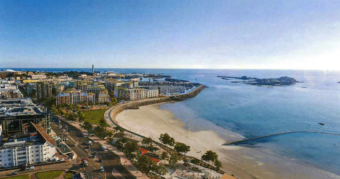
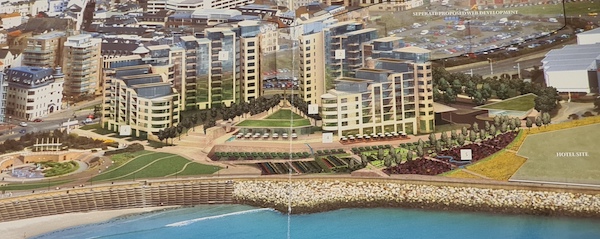
Pictured: The States of Jersey Development Company's new vision for 'South West St. Helier'.
As of last month, new plans have emerged for another rethink of the Waterfront area.
Plans have been formally submitted for an ambitious redevelopment of the Waterfront, including 1,000 units of accommodation, 568 new trees, four restaurants, two bars, 10 cafes, two gyms, an outdoor lido, an art-house cinema, two GP practices, a nursery, a large convenience store and six smaller shops and 17,000 sqm of office space.
Under the States of Jersey Development Company's vision, the existing cinema building, car parks and La Fregate will also make way for new gardens, cycle routes, pavilions and a new slipway onto the beach at West Park.
Will they come to fruition? We shall see... But first, there are the hurdles of a bid to rescue La Frégate café and public planning inquiry to overcome...


Comments
Comments on this story express the views of the commentator only, not Bailiwick Publishing. We are unable to guarantee the accuracy of any of those comments.