
FOCUS: Fields earmarked for affordable homes in short-term Island Plan
Monday 19 April 2021
11 sites – most of them agricultural fields – have been earmarked for affordable housing in the new ‘bridging’ Island Plan, which is published today.
If approved, up to 582 homes – although the target is 450 - will be built across seven parishes with 18 fields lost. The total land built on will be 71.7 vergées, roughly equivalent to 30 football pitches.
It forms part of a proposal to build 1,500 affordable homes over the three-years of the bridging plan, between 2022 and 2025.
In total, the plan set outs to build 4,150 homes by the end of 2025. Of the 2,650 that will be sold on the open market, 1,400 homes are either already under construction or have planning permission, 750 will be built in town and 500 outside of town.
Of those classed as “affordable”, 625 are under construction, 425 will be in town and 450 would be built on rezoned fields.
The exact number, type, size and tenure of homes on the 11 sites will be determined through the planning process.
The sites earmarked for rezoning are:
Field G392A, Le Clos des Fonds, Grouville
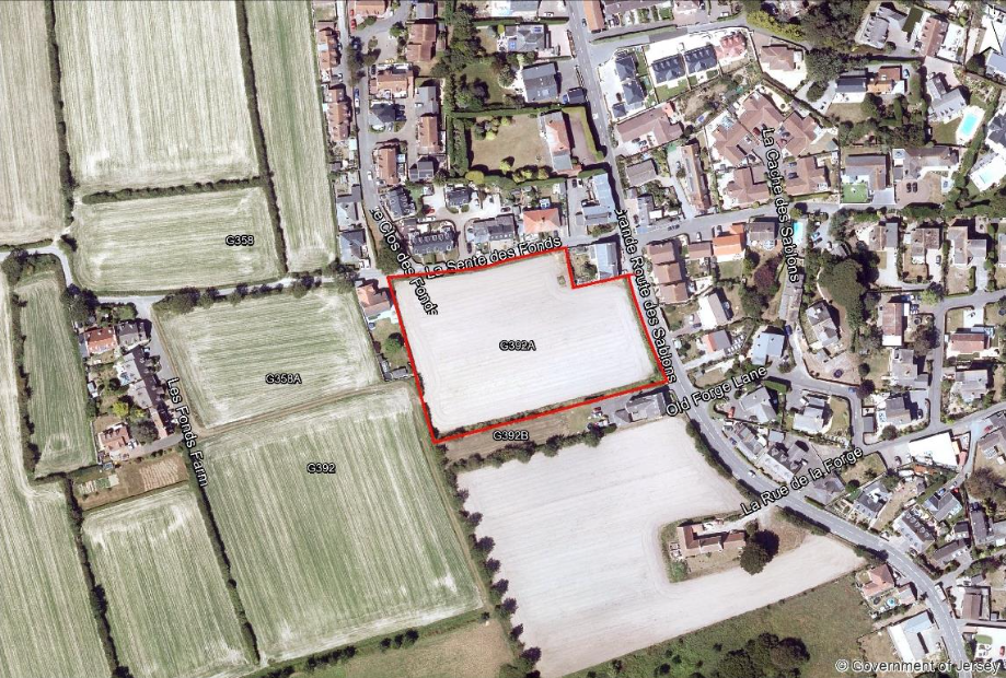
- 23-34 homes
- 4.2 vergées
- The Bridging Island Plan explains that the site is an “extension of the existing development along La Grande Route des Sablons and La Sente des Fonds."
- It adds: “The location would probably suit the provision of either family homes or has the potential for a mixture of ‘rightsizing’ accommodation.”
Fields: H1186a, H1189 and H1198, La Grande Route de St. Jean, St. Helier
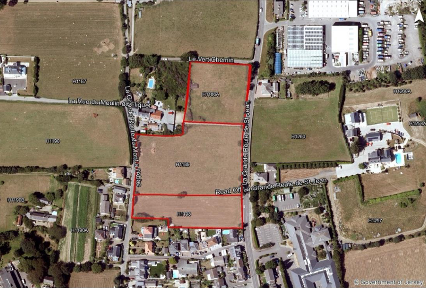
- 52-76 homes
- 9.4 vergées
- “Best suited to the provision of family accommodation."
- “Existing development along La Grande Route de St. John and La Grande Route de Mont à L'Abbé."
Field H1219, La Grande Route de Mont a L’Abbé, St. Helier (6.7 vergées)
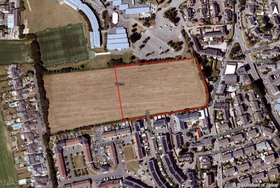
- 36-54 homes.
- “Best suited to the provision of family accommodation to increase family housing options for town.”
- “The site is adjacent to the built-up area on the outskirts of St. Helier and would represent an extension of the existing development along St. John’s Road, Clark Avenue, and the existing housing development located along the southern boundary at, Uplands Drive and Le Clos Vaze.”
Field J525, La Rue des Buttes, St. John
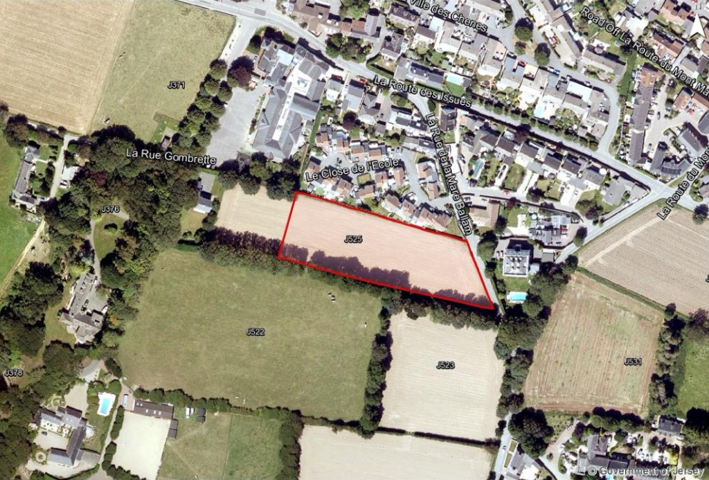
- 8-27 homes
- 3.3 vergées
- “Best suited to the provision of family accommodation.”
- “Represents extension of St. John’s Village.”
Fields: MN389 and MN390, La Rue de la Haye, St. Martin
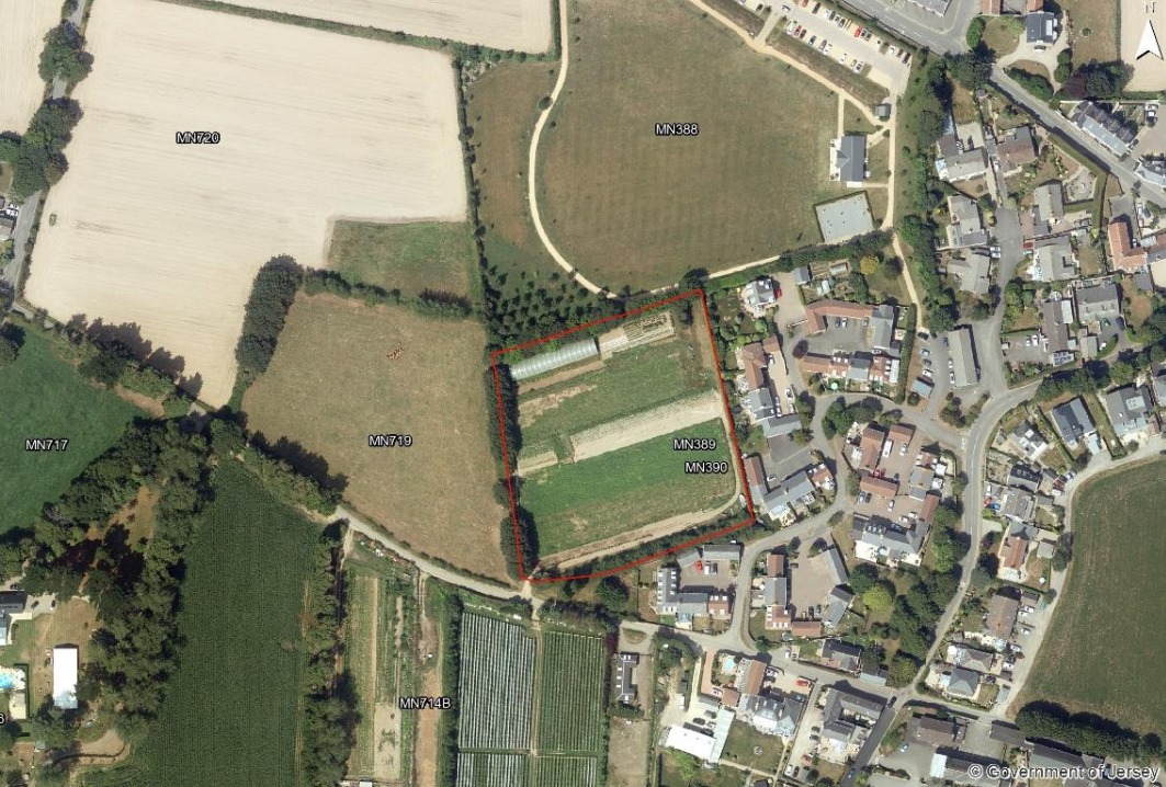
- 27-41 homes
- 5.5 vergées
- “Could provide a range of accommodation types including family homes or may also suit a mix of family and ‘rightsizing’ accommodation”
- “Represents extension of the existing development off La Grande Route des St. Martin and Le Rond Collas, which lead directly into the village centre”
Field MN410, La Rue des Buttes, St. Martin
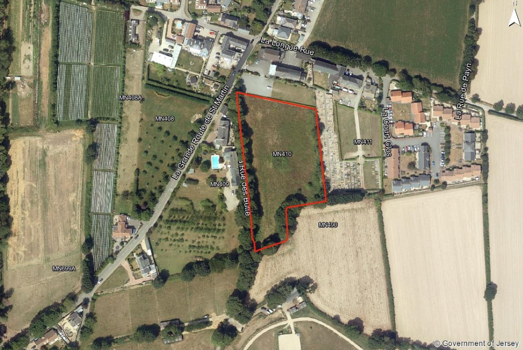
- 23 and 34 homes
- 4.2 vergées
- “This site could provide a range of accommodation types, including family homes.”
- “Represents extension of the existing development along La Grande Route de St. Martin.”
- This field was earmarked for development in the last Island Plan.
Fields: O594 and O595, Le Clos de la Fosse au Bois, St. Ouen
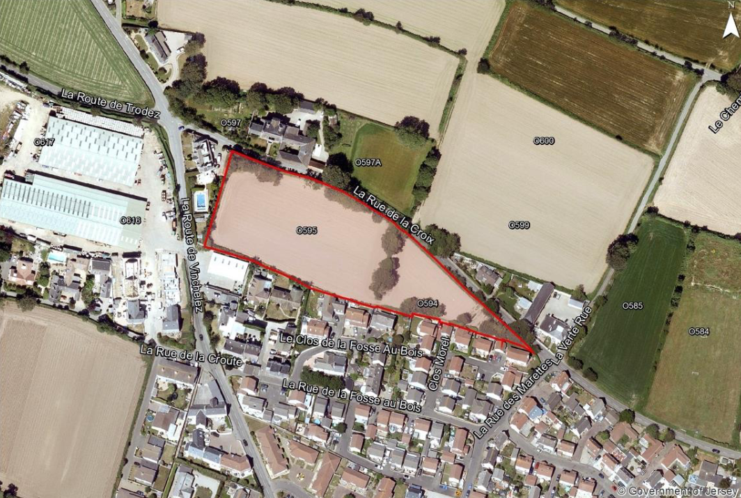
- 30-45 homes
- 5.6 vergées
- “Site could provide for a range of accommodation types including provision for right-sizers.”
- “The site is next to the built-up area of St. Ouen and would represent an extension of the existing development along La Rue de la Croix.”
Field P632, La Route du Manoir, St. Peter
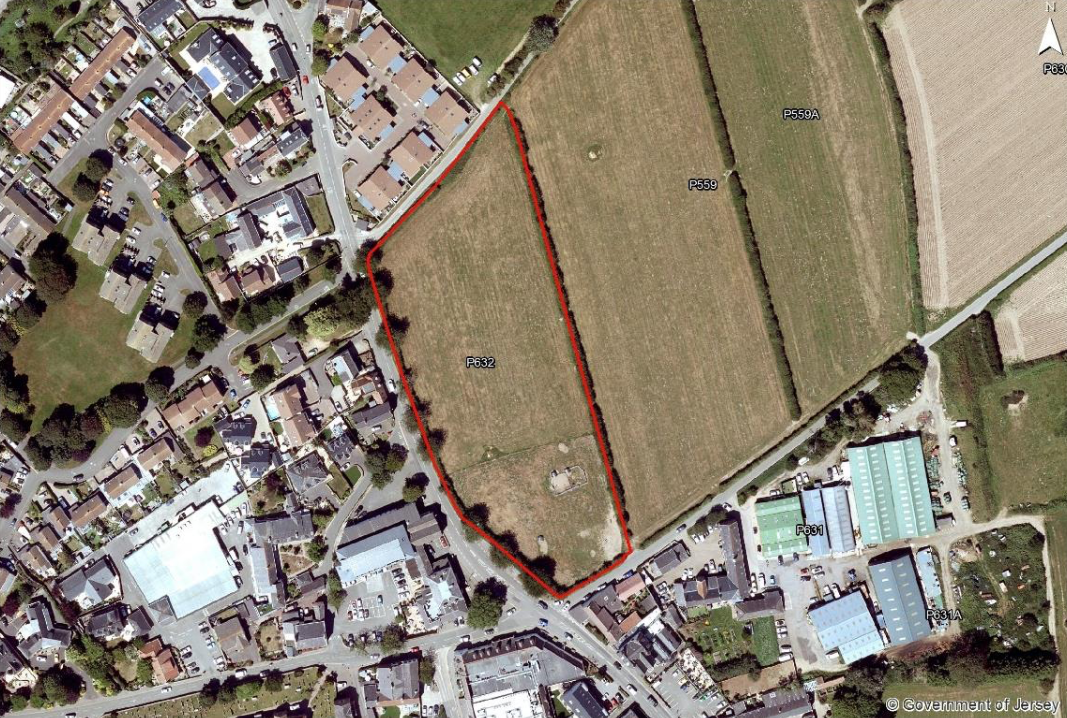
- 39-59 homes
- 7.2 vergées
- “Best suited to the provision of family accommodation.”
- “The site is adjacent to the built-up area of St. Peter and would represent an extension of the existing development along La Grande Route de St. Pierre.”
- A previous planning application to build 65 homes on the field was rejected in 2018 after a public inquiry and independent planning inspector report.
Fields: S413, S415, S415A and S470, Le Grande Route de St. Martin, St. Saviour
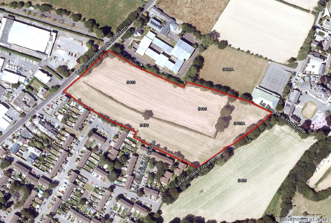
- 68-102 homes
- 12.5 vergées
- “A mix of family homes and age-related housing could provide a good housing mix for this site.”
- “The site would allow for dense development adjacent to the built-up area and would also provide an opportunity to link with Les Cinq Chenes Estate to the south.”
- The fields were part of Five Oaks site that reached the five-site shortlist for the Our Hospital project.
Field S530, Princes Tower Road, St. Saviour
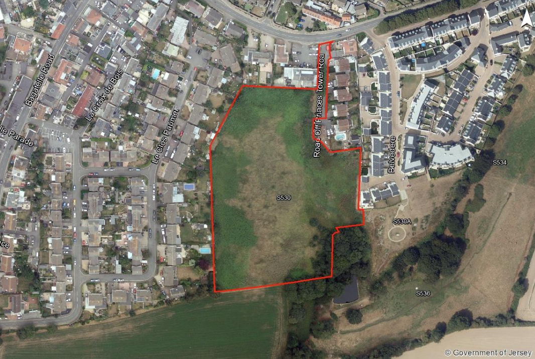
- 60-90 homes
- 11.1 vergées
- “This site could provide for a range of accommodation types. However, the location would probably suit the provision of family homes."
- “The site is adjacent to the built-up area of Five Oaks and would represent an extension of the existing development along Princes Tower Road and Bagatelle Road.”
Field: S729 - Southern section of former Longueville Nurseries site, New York Lane, St. Saviour
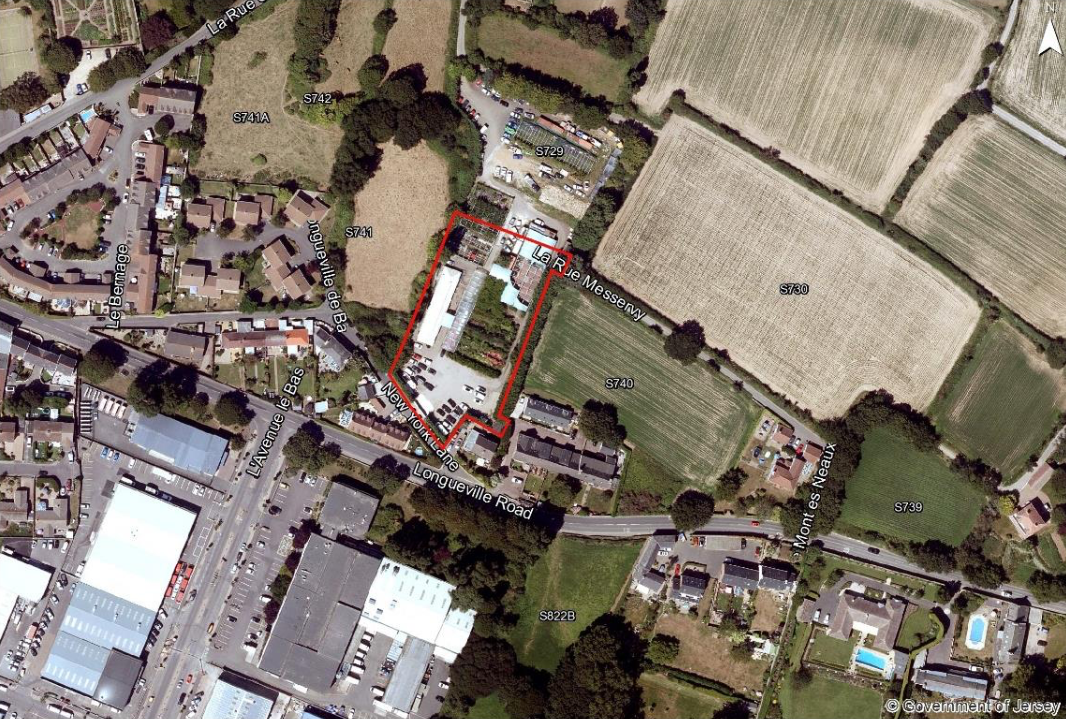
- 14-20 homes
- 2.5 vergées
- “Best suited to the provision of family accommodation.”
- “The site is adjacent to a built-up area of St. Saviour and would represent an extension of the existing development along Longueville Road.”
The 367-page bridging Island Plan is an extensive document which Express will explore in more depth over the coming days.
Other significant features in it include the following.
- Official designation of Les Quennevais as the island’s ‘secondary urban centre’. Practically, this means “encouraging the redevelopment of already developed land and buildings at higher densities, and by accommodating a broader range of employment uses, such as the development of office accommodation.”
- A distinct plan for town, which includes support for “well designed taller and denser” buildings, protection of existing open spaces, and the creation of a 'Sustainable Communities Fund' to invest in “public realm improvements."
- The creation of a “settlement hierarchy” that prioritises development in areas which are already more densely developed.
- Expansion of the Jersey Coastal Park, with the aim that it will form 30% of the island by 2030.
- Incorporation of Climate Change and Carbon Neutral policies into the plan by, for example, introducing new building requirements and factoring in low-carbon transport into each development.
- Derelict glasshouses should not be built on. The plan is clear in this regard: “In planning terms, glasshouses are considered to be temporary structures associated with the agricultural use of the land. When glasshouses are redundant to the horticultural industry or are derelict, they should be removed, and the land brought back into crop production or grazing use,” it says.
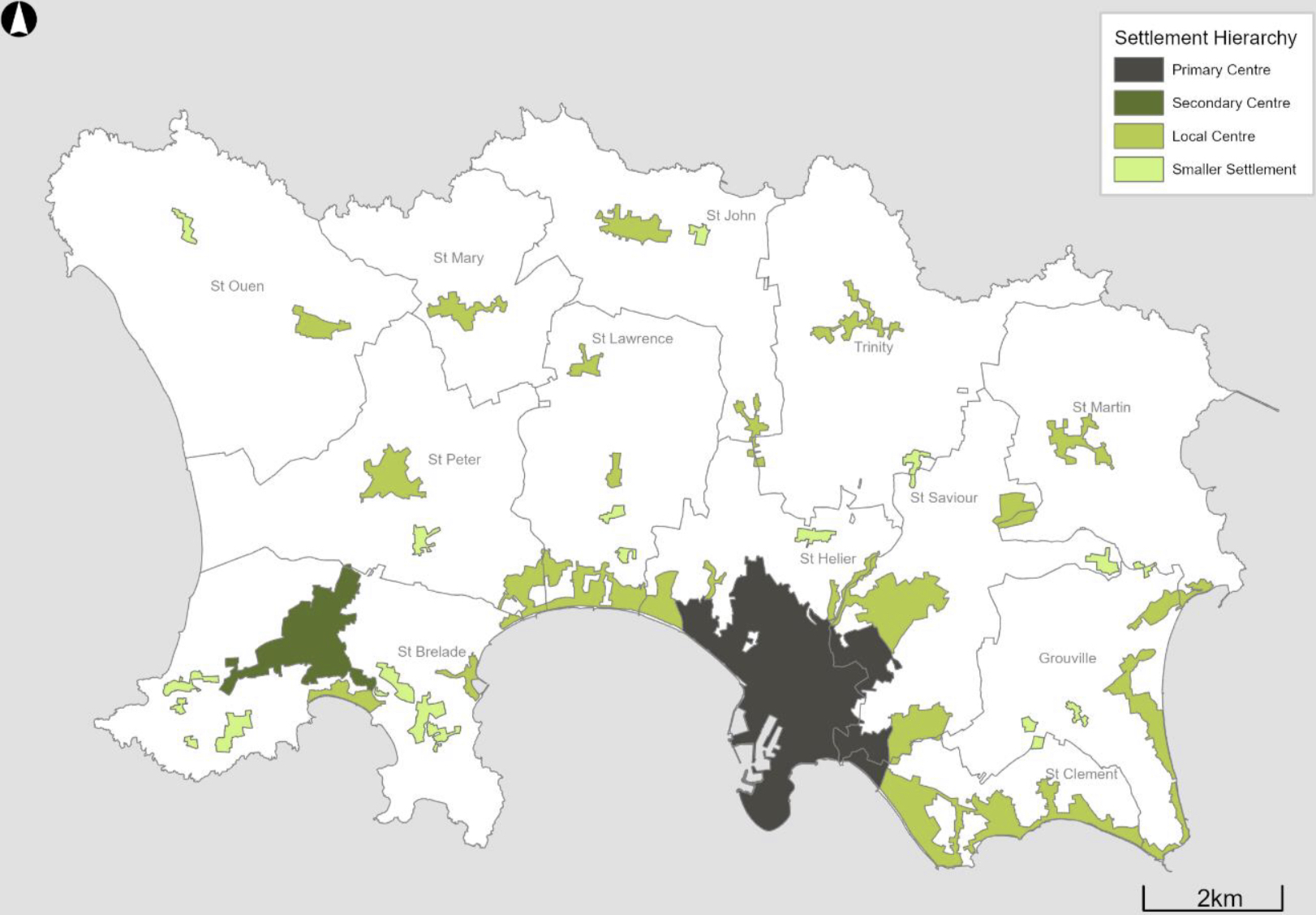
Pictured: The plan includes a new ‘settlement hierarchy’, which priorities development across the island.
Speaking about the plan, Environment Minister John Young said: “This draft Island Plan is a giant step forward. It updates all our development policies and sets an ambitious vision to enhance Jersey as a special place, protect its environment and unique island identity, and provide the homes, employment and infrastructure that sustain family and community life.
“I want to encourage every islander to get involved in the 12-week public consultation. Everyone should see this as an opportunity to have their say about the future of the island and its development, not only in the coming years, but also how we might best respond to the long-term challenges that the plan identifies."
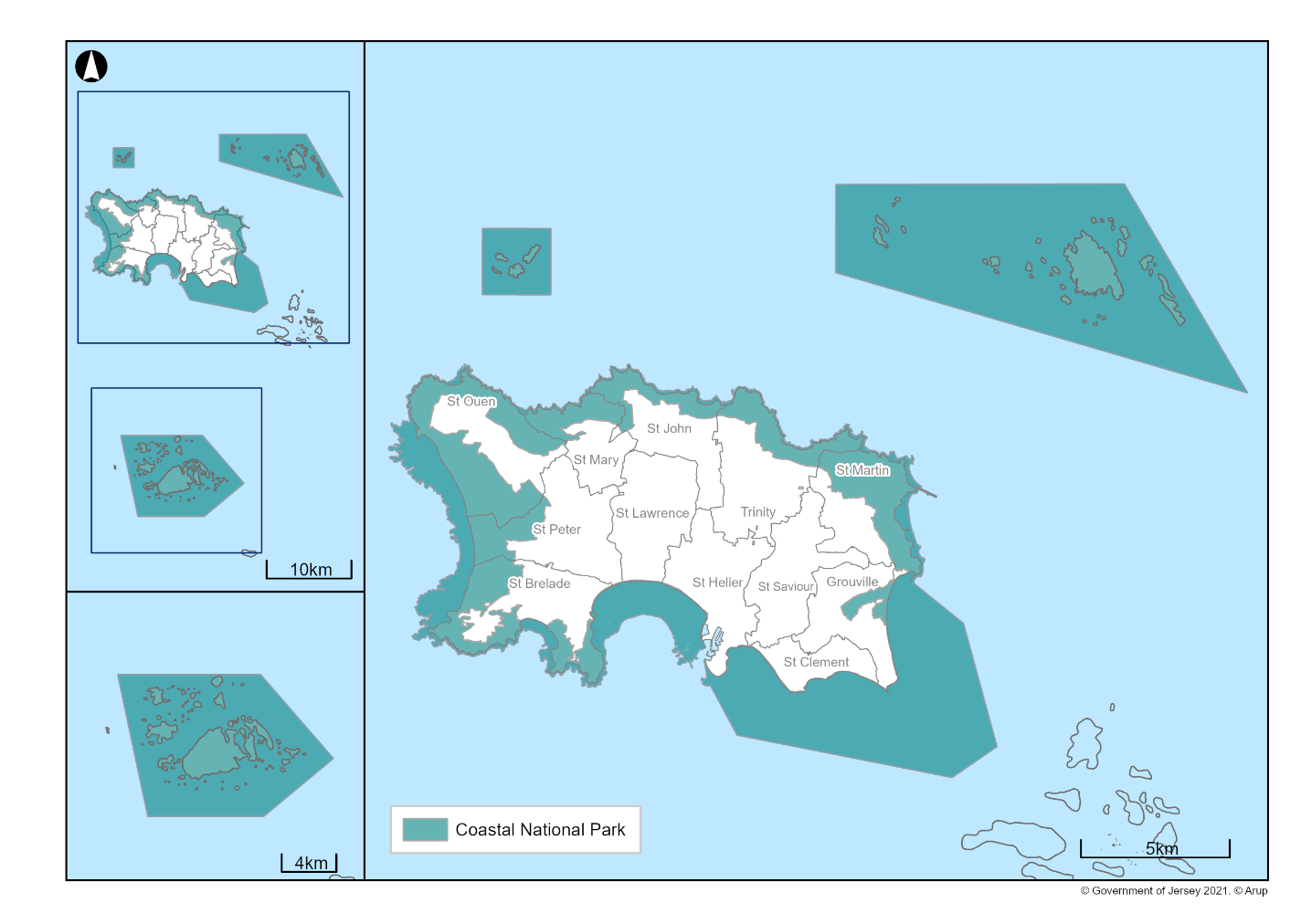
Pictured: The plan proposes extending Jersey’s Coastal National Park.
He continued: “Participating in the consultation means your views will be considered by States Members and by the independent planning inspector later this year before the plan is debated in spring 2022.
“The bridging Island Plan is the start of a great future for Jersey, and I want everyone to be involved.”

Pictured: The plan’s sources of housing supply.
A series of online briefings will be held throughout May, and civil servants who are members of the Island Plan Review team will also attend discussions in each of the parishes.
READ MORE...
EXPLAINED: What is the Island Plan? And how does it affect me?


Comments
Comments on this story express the views of the commentator only, not Bailiwick Publishing. We are unable to guarantee the accuracy of any of those comments.