Select a region


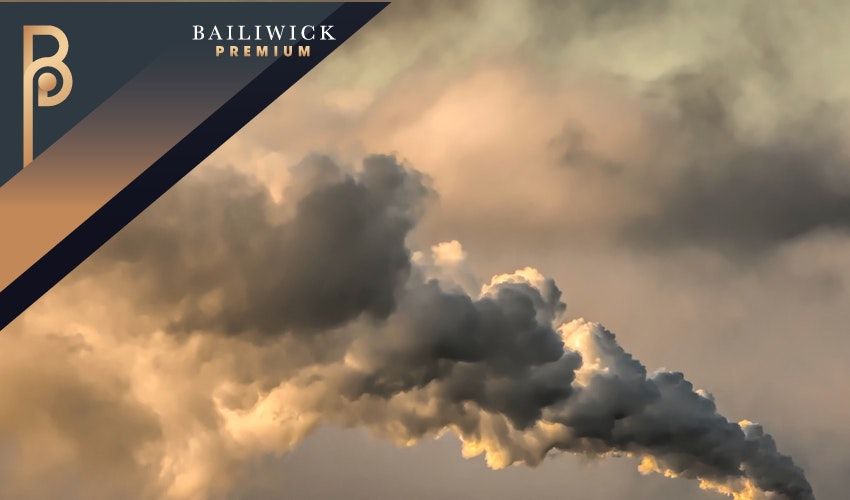

This year marks a quarter-of-a-century that Jersey has been keeping a close eye on its air quality... How exactly does the process work? When is air quality at its worst? And have things improved over the past 25 years?
Express investigates...
The air quality monitoring initiative started in 1997.
This was around 20 years after the catalytic converter - a device used to reduce pollutant gases caused by vehicles - was invented and just four years after it became law for all petrol cars manufactured in the UK to have one.
Just three years later came the limiting of benzene concentrations in petrol to 1% in the year 2000.
This has, of course, had an impact on Jersey's air quality - even though the population and subsequent car use has increased over the years.
Annual mean NO2 concentrations at historic kerbside, roadside and urban background sites (Weighbridge, Georgetown, Beaumont, The Parade, Broad Street, and Le Bas) from 2004 onwards have been shown to be decreasing.
But how has the island been faring more recently?
Fortunately, it seems, fairly well - measurements across all monitoring sites are well within the European Union guidelines for NO2 and hydrocarbon concentration.
The latest results for 2021 and monitoring programme process are detailed in a 71-page report.
This £16,000 report presents the results for 2021 of an ongoing programme of air quality monitoring in Jersey, carried out by Ricardo Energy & Environment on behalf of the Natural Environment Department of the Government of Jersey.
This ongoing monitoring programme has provided a long-term dataset of pollutant concentrations.
Pictured: Automatic NOx monitoring site at Beresford Street, St. Helier.
The objective, as in previous years, was to monitor at sites where pollutant concentrations were expected to be high and compare these with background locations. The monitoring sites consisted of urban and rural background sites, in addition to locations where higher pollutant concentrations might be expected, such as roadside and kerbside sites, as well as locations close to specific emission sources (for example, a petrol station).
This report presents the results obtained in the 2021 survey and compares the data from Jersey with relevant air quality limit values, objectives and guidelines as well as data from selected UK monitoring stations and previous years' monitoring programmes.
The pollutants measured are nitrogen dioxide (NO2), and a range of hydrocarbon species: benzene, toluene, ethylbenzene and three xylene compounds.
A mixture of nitrogen dioxide (NO2) and nitric oxide (NO) is emitted by the combustion processes. The mixture of oxides of nitrogen is termed NOx. NO is subsequently oxidised to NO2 in the atmosphere. NO2 is an irritant to the respiratory system and can affect human health.
Ambient concentrations of NO2 are likely to be highest in the most built-up areas, especially where traffic is congested, or where buildings either side of the street create a ‘canyon’ effect, impeding the dispersion of vehicle emissions.
There are many sources of hydrocarbon emissions. Methane, for example, is a naturally occurring gas, while xylene compounds are synthetic and used in many applications, for example as solvents in paint. A range of hydrocarbons are found in vehicle fuel and occur in vehicle emissions.
n most urban areas, vehicle emissions constitute the major source of hydrocarbons, in particular benzene. There is the potential they may be released to the air from facilities where fuels are stored or handled such as petrol stations.
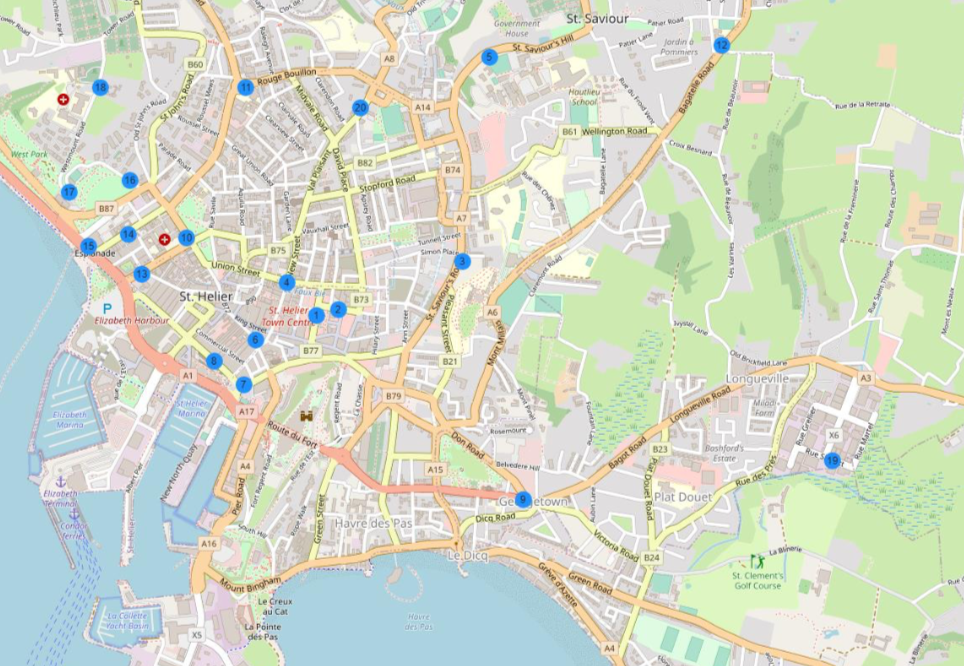
Pictured: Site locations in St. Helier's town.
A wide range of hydrocarbons are emitted from fuel storage, handling and combustion. It is not easy to measure all these hydrocarbon species (particularly the most volatile) without expensive continuous monitoring systems.
However, there are four species associated with fuels and vehicle emissions which, though not the largest constituent of such emissions, are easy to monitor using passive samplers due to their moderate volatility. These are benzene, toluene, ethylbenzene and xylene. Diffusion tubes are available for monitoring this group of organic compounds and are known as ‘BTEX’ tubes (BTEX being an acronym for the compounds measured).
At the beginning of the year there were 17 locations measuring nitrogen dioxide, however over the course of the year four locations were closed and a further five were opened, meaning by the end of the year there were 18 locations on the island. The suite of hydrocarbon species were monitored using ‘BTEX’ diffusion tubes at five sites, one of which changed location during the year.
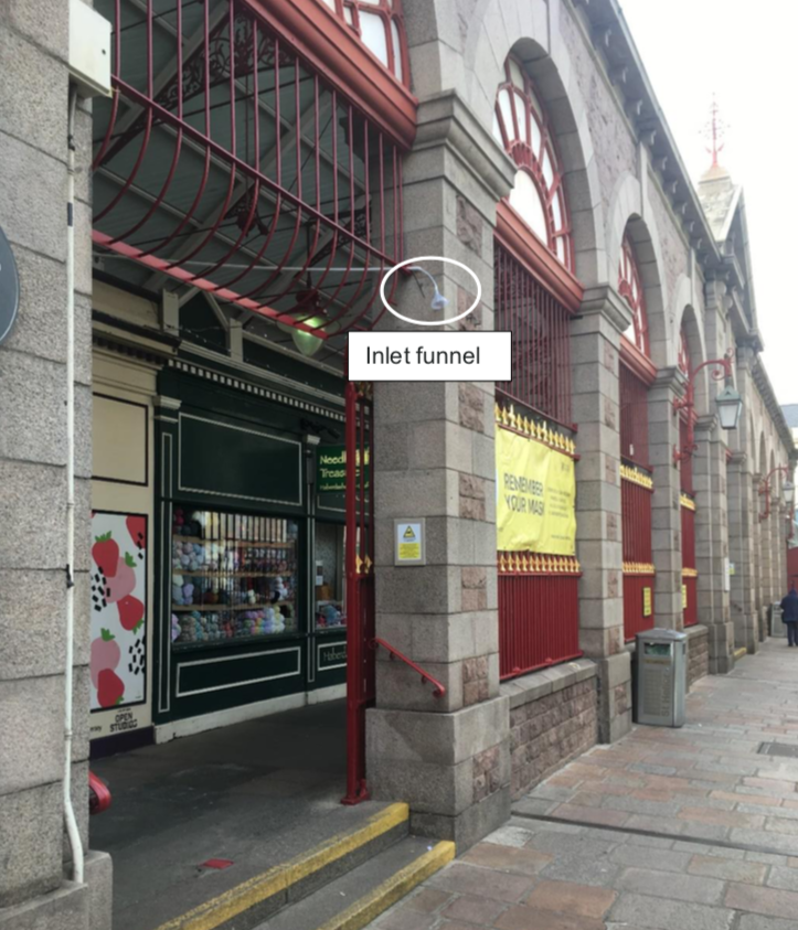
Automatic monitoring of oxides of nitrogen was carried out at the Central Market, Halkett Place, in St. Helier between January the 1st and November the 4th. The site was then moved to the other side of the Central Market, located on Beresford Street and began monitoring on the 11th November.
These two sites are roadside locations where levels of NO2 are expected to be high and where members of the public are regularly exposed for periods of one hour or more. The inlet funnel which carries out the automatic monitoring is visible as a white tube, about four metres high.
Diffusion tubes were also used to monitor NO2 at these two sites, as well as in a range of different environments around Jersey.
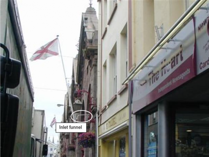
Pictured: Automatic NOx monitoring site at Halkett Place, St. Helier.
After the March 2021 exposure, the Esplanade (Hospital) and Kensington Place (Hospital) sites were closed down as these were originally designed to monitor base line NO2 levels for the new hospital project at Gloucester Street. They were replaced by three new sites: Overdale (Nursery), Overdale (Bend) and Overdale (Entrance), to monitor the new construction location.
Les Quennevais school (old) was moved to a new site named Les Quennevais school (new) for the October exposure.
BTEX hydrocarbons were monitored at six sites during 2021, including Hansford Lane. This site was close to a paint spraying process, a potential source of hydrocarbon emissions, especially toluene and xylenes. However, the business moved and so the site was considered no longer beneficial. It was moved after the April 2021 exposure to Rue de Pres, in an industrial estate near to another paint spraying business. The aim here was to investigate sites likely to be affected by different emission sources and compare these with background sites, such as the Le Bas Centre.
The Faux Bie site is located near a fuel filling station, a potential source of hydrocarbon emissions including benzene. The monitoring site is between a fuel filling station and a nearby block of flats and is intended to represent public exposure to emissions from the filling station. The fuel supplier uses a vapour recovery system to reduce emissions when filling the storage tanks and has done so since December 2016.
The Harrington’s Garage site was introduced as a replacement to the Airport Fence location and has been in operation since January 2019. The site is located on the A13 Rue de Genets, aiming to assess levels of BTEX from a typical garage with petrol and diesel storage and dispensing facilities.
Covid-19 has had unprecedented impacts on daily life for all of the world and Jersey is no different. When looking at the temporal, especially seasonal, variations the impacts of the pandemic must be considered. The latest report considers the impact of the various levels of restrictions.
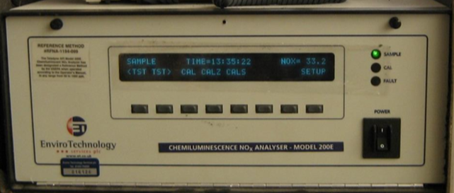
Pictured: Automatic NOx analyser used at Halkett Place and Beresford Street.
As tourism is a major part of Jerseys economy and has an impact on the island's air quality, the variety of restrictions on travel over the course of the pandemic must also be considered when looking at the data from 2021.
In 2021, total arrivals by air and sea to the island rose by 62% to 405,200 but were still 66% lower than the numbers recorded in 2019.
Covid-19 restrictions had a significant impact on almost all onsite activities, strict stay at home orders reduced the frequency of LSO (Local Site Operator) site visits to the automatic instrument and of diffusion tube changes.
With regards to diffusion tubes, they are to be exposed for a set period, with the year being divided into periods approximating to calendar months.
This results in the duration of the exposure periods varying between four and five weeks. However, due to the restrictions arising from the covid-19 pandemic it was not possible for the collection and deployment schedule to be followed at the beginning of 2021.
This resulted in the January deployment being missed, the November 2020 deployment was collected in February 2021, resulting in an exposure period over 2000 hours. Results from exposure periods outside this range must be considered compromised and non-representative of actual concentrations, as the rate of diffusion may not have been accurately defined. For the purposes of this report, the extended November 2020 exposure was not included in any analysis in this report.
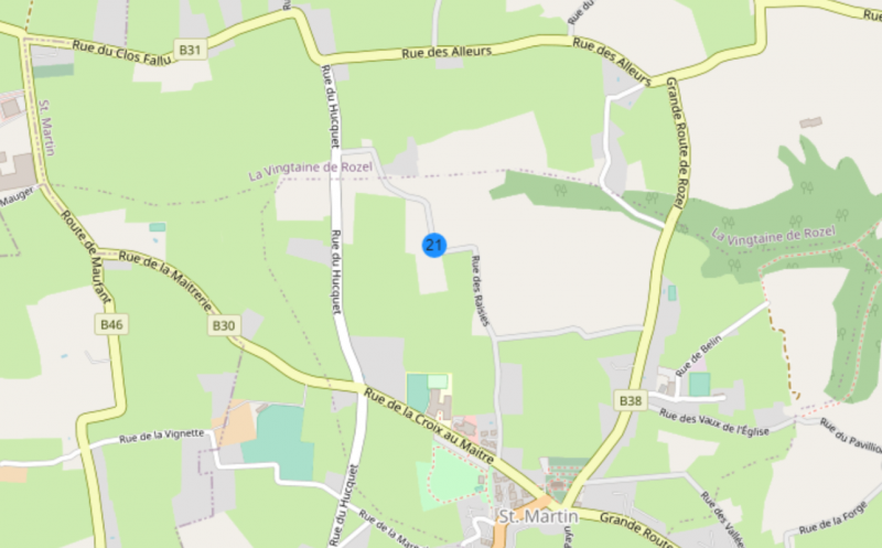
Pictured: Site locations in Eastern Jersey.
It is worth noting that it advises that automatic monitors are serviced once every six months, within three weeks of a QA/QC audit. LSO calibrations are, for the site type of Halkett Place, to be carried out every four weeks. Covid-19 restrictions meant that the four weekly scheduled calibrations were not always able to be undertaken.
In order to evaluate the automatic data, the 2021 audit and available LSO calibrations were thoroughly checked. On the establishment that the audit showed no faults with the instrument the data was thoroughly checked before being reviewed by an expert panel, who made the decision that the data could be marked valid.
The automatic instruments at Halkett Place show the levels of NO2 concentration to be 21 μg m-3, showing a slight increase from the 2020 annual mean of 20 μg m-3.
There was a clear peak in the early morning between 07:00 and 08:00, with another slight peak in the afternoon rush-hour.
The morning peak is thought to reflect early activity of market retailers arriving to set-up for the day using refrigerated vehicles and daily refuse collections.
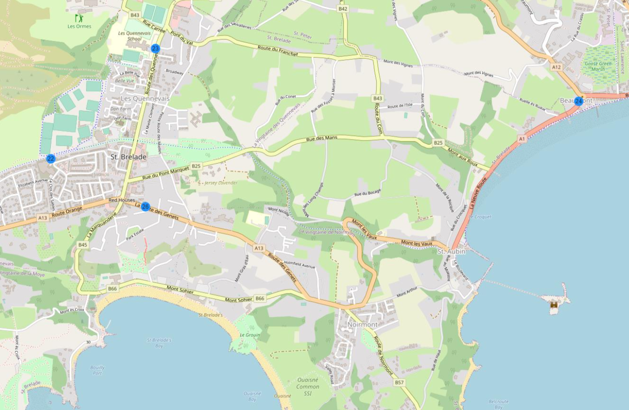
Pictured: Site locations in Western Jersey.
These vehicles may need to be left with engines running whilst carrying out their operations, contributing to NO2 levels.
Outside of town, annual mean NO2 concentrations at Jersey’s urban sites appear to have generally decreased between 2003 and 2012.
Since then, concentrations have remained largely stable at most sites, with a slight decrease occurring in 2020 and 2021.
Pollutant concentrations are expected to fluctuate from year to year, due to meteorological and other factors, the covid-19 pandemic being the obvious major one for 2020 and beyond.
Measurements across all sites remain well within the European Union guidelines which state that NO2 concentration should remain below an annual mean of 40 μg m-3. As such, an expansion of the automatic NO2 monitoring network is not recommended at this time.
The four sites which measured annual averages of BTEX hydrocarbons were also within the guidelines of 5 μg m-3.
Faux Bie Terrace represents the nearest relevant public exposure to a petrol station and measured the highest annual mean benzene concentrations, of 0.6 μg m-3. Concentrations at this site here had sharply increased until 2016, followed by substantial decreases after a stage 2 vapour recovery system was installed that year.
Over the long term, hydrocarbon concentrations have generally decreased at La Bas Centre and Halkett Place. With the paint-spraying business at Hansford Lane closed since 2019, the concentrations measured here have also continued to decrease.
Overall, annual mean concentrations of BTEX hydrocarbons were slightly lower than those measured in recent years.
£250k for new air monitoring project
School air monitoring project in doubt amid costs row
44 out of 46 school air monitors not working
Nearly half of island's 'real time' air monitoring devices do not work
All schools to get air quality monitors (2019)
Tunnel vision: £2.5k to keep an eye on air quality (2017)


Comments
Comments on this story express the views of the commentator only, not Bailiwick Publishing. We are unable to guarantee the accuracy of any of those comments.