Select a region


A Minister has broken ranks in a bid to get the foreshore map released, and is pushing for changes to the Government's “ambiguous, confusing and unnecessarily complex” draft policy on coastal encroachment fines.
International Development Minister Deputy Carolyn Labey has published an amendment to the Government’s foreshore policy which is due to be debated by the States Assembly on 19 January.
Years in the making, the policy was finally released in September last year, featuring a ‘sliding scale’ of charges relating to the nature of the encroachment and how long it has been there.
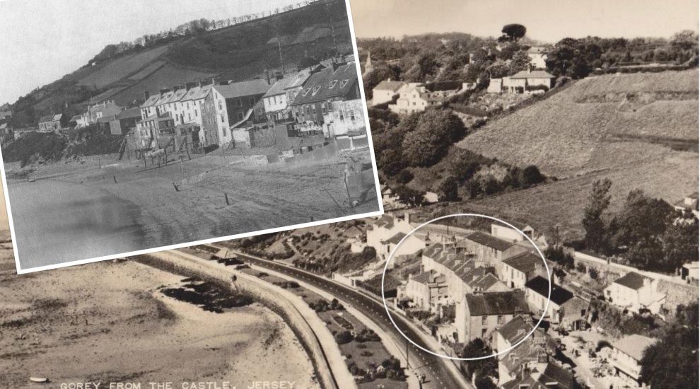
Pictured: The 'Foreshore' is vaguely defined as the land between the high and low tide marks - but historic images show how difficult that is to define at present.
More than 400 properties are affected by the policy, which sees owners of coastal homes forced to pay ‘compensation’ to the Government if their properties are deemed to encroach on the foreshore, which is defined as the zone between the high and low tide marks.
While the Government has drafted a map detailing where it believes the foreshore is, they have so far refused to release it, meaning that islanders won’t know if their properties sit on the controversial chunk of land until they are contacted.
Deputy Labey, who has been pursuing the issue of the foreshore for several years, is trying to force the Government’s hand in publishing the map by asking her fellow States Members to agree the policy should include a request to the Minister for Infrastructure, Deputy Kevin Lewis, to “provide a map, setting out the public boundary, as part of the encroachment policy document”.
In the report accompanying her proposals, the Grouville representative questioned why it would be inappropriate to publish “a definition and a map setting out the location of the boundary position of publicly owned land."

Pictured: The Minister for Infrastructure Deputy Kevin Lewis published the long-awaited policy in September.
In addition, the International Development Minister is suggesting changes to the way “new and recent encroachments” should be identified and dealt with. Under her proposals, they would include any encroachments that occurred between 13 June 2015 and the date the Assembly votes on the policy.
Minor encroachments would be permitted to remain under conditions set by the Minister while ‘interfering’ ones would be required to be removed and the foreshore restored to the state it was in before the encroachment.
Encroachments that do not interfere with access to the foreshore could be allowed to stay under “reasonable conditions” that could include a “reasonable compensation."
'Historic' encroachments, meanwhile, would be dealt with in the same manner except that those that interfere with access could be removed with the owner asked to contribute “appropriately” to the cost.
Deputy Labey’s proposals also include several changes to the document, including the removal of a number of paragraphs relating to ‘Categories of foreshore encroachment’, ‘The principles of policies’ and ‘The Public’s landside ownership of the foreshore’.
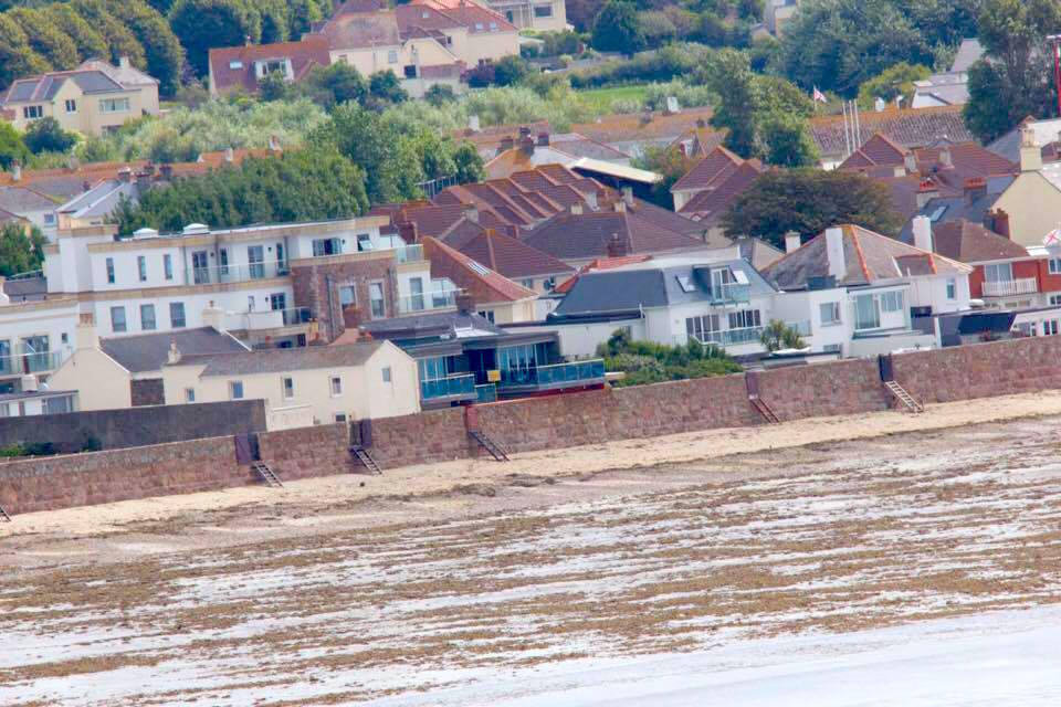
Pictured: 400 properties would be affected by the new policy, but a map still has to be released.
In her report, she noted that it was hoped the revised policy would bring “much needed clarity and transparency” in the approach being followed by the Minister but that in fact “it didn’t advance the situation one bit”, describing it as “ambiguous, confusing, open to interpretation” and adding it wouldn’t give any comfort to the public.
She called instead for a clear and transparent policy, that would recognise “the generosity of the Crown” and the fact that the transfer of the foreshore and seabed was made with “a different objective, namely renewable energy projects, in mind”.
“The Minister’s proposed revised policy is unnecessarily complex, lacks transparency and fails to supply a Map required in Q1 2021, setting out the boundaries of the publicly owned land,” she wrote.
“It wilfully sets up a position where the public are invited to contact the department 'to discuss' and have to actively seek clarification from the department in order to establish a defined position over the publicly owned boundary. This defined position relies on whatever is interpreted by the Minister, the Law Officers and the Officers.”
Deputy Labey also criticised the Infrastructure Minister for his “blatant disregard” of the views and findings of the Jersey Complaints Panel, which upheld the complaint of unfairness by Alan Luce and Julian Mallinson, who were fined around £50,000 between them for alleged encroachments.
The Grouville representative’s comments echo those she made as part of a Scrutiny Review opened last year to examine the fairness of the policy.
She was among many voices, including a former Bailiff, the head of the Law Society, the chair of the States Complaints Board, and Mr Luce and Mr Mallison, who criticised the policy.


Comments
Comments on this story express the views of the commentator only, not Bailiwick Publishing. We are unable to guarantee the accuracy of any of those comments.