Select a region


The Government has drafted a masterplan detailing where it believes the foreshore is, and the hundreds of coastal properties lying on the disputed land – but is refusing to release it.
Jersey Property Holdings (JPH) is soon to start contacting all islanders with property ‘encroaching’ on the area – defined as being between the historic high and low tide mark – in order to “discuss their boundary situation."
But, ahead of that, they are declining to share the map they’ll be using – meaning that islanders won’t know if their properties sit on the controversial chunk of land until they are contacted.
The revelation came in the proposed new Foreshore Policy, which was published very late on Friday by the Infrastructure Minister and is due to be debated in States Assembly in November.
As Express revealed last week, the new policy suggests a ‘sliding scale’ of retrospective charges for those that have bought property on, or built on, the ill-defined land. Those charges vary according to the severity of encroachment and the length it has been there.
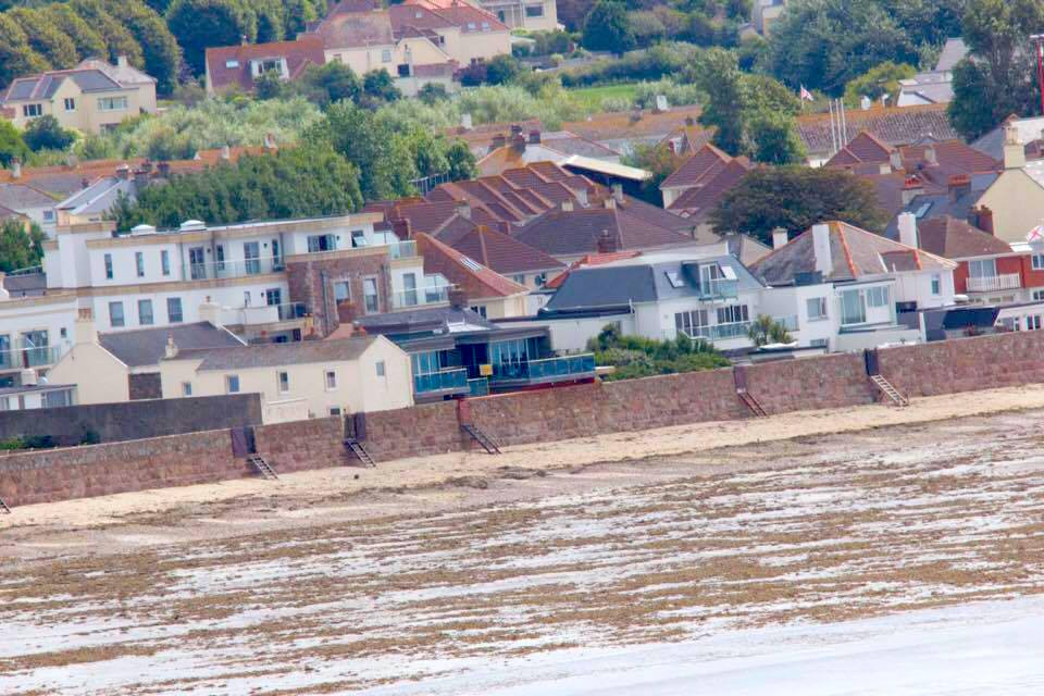
Pictured: More than 400 properties are believed to sit on the Foreshore.
The document acknowledges that, at the time the Foreshore was passed from the Crown into Jersey ownership, there was no complete map of the Foreshore.
Since then, however, it said that a project had been undertaken to find the landside boundary of the Foreshore involving extensive site inspections and the production of individual reports on sections of coastline around the island.
That work also involved identifying cases of adjoining coastal properties that have extended over that line or where properties have built up to or onto seawalls – the number of which is believed to be more than 400, a source told Express.
While analysis is still taking place, a ‘Master Schedule’ has been created providing a “summary of the key findings”.
Once complete, it is intended that it will be a “live document” that will be updated “upon each encroachment case being resolved and the new length of boundary line being set.”
The report says that document will be exempt for two reasons: “it is derived from privileged and confidential legal advice provided by the Law Officers’ Department” and that “it contains information which is effectively private to individual property owners, and it would be inappropriate to openly publish that.”
However, the report adds: “However, it is JPH’s intention to plan to start contacting individual property owners on a planned basis to discuss their boundary situation, and this will be as the department’s resources permit. And should any owner whose property adjoins the Foreshore wish to contact the department to discuss their boundary at that specific location, they are free to do so on providing proof of identity/ownership.”
It continues: “As mentioned above, having considered the nature and extent of the Foreshore encroachments as gleaned from the research carried out, JPH is minded to advise and recommend “default boundary line positions” as set-out on the Master Schedule.
“The “default boundary line positions” are the markers at which JPH will recommend that boundaries are ratified with adjoining property owners, subject to:
The publication of the policy comes just days ahead of a crucial vote in the States Assembly in which Deputy Carolyn Labey will ask for the Government to cease and desist with its Foreshore compensation regime.

Pictured: Deputy Carolyn Labey, who is fighting to put an end to the Foreshore controversy.
The former Minister who brokered the Foreshore deal with the Crown, Sir Philip Bailhache, has spoken out against the Government's tactics, saying that they do not match the spirit of the Queen's gift.
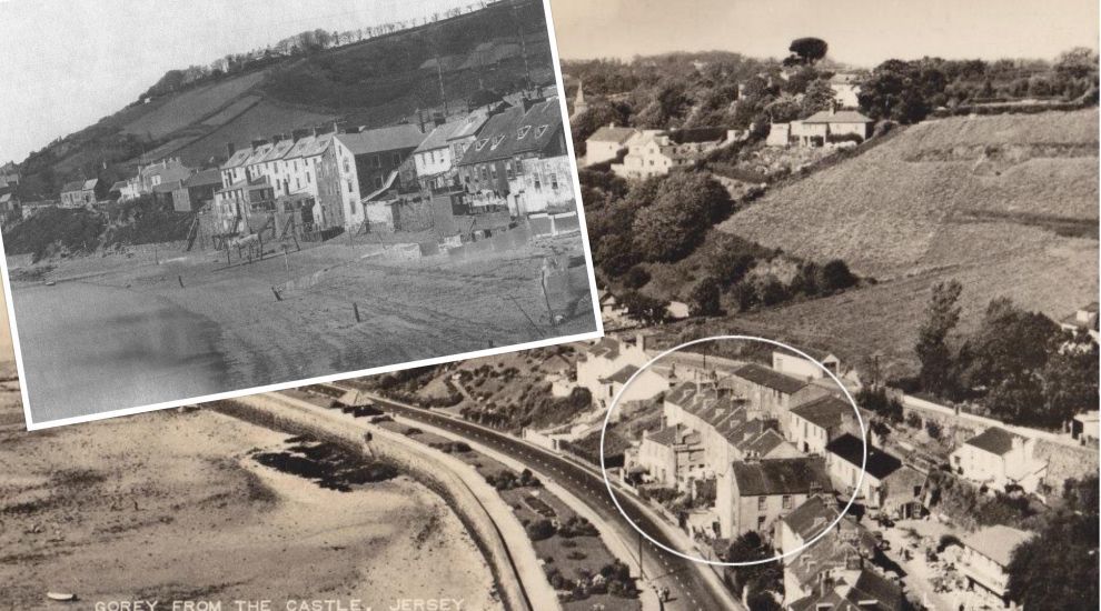
Pictured top: The 'Foreshore' is vaguely defined as the land between the high and low tide marks - but historic images show how difficult that is to define at present.


Comments
Comments on this story express the views of the commentator only, not Bailiwick Publishing. We are unable to guarantee the accuracy of any of those comments.