Select a region


Information on coastal defences gathered by a drone survey could inform measures to protect islanders from future flooding, with ocean levels expected to rise significantly in the coming years.
Earlier this month, a drone survey of St Aubin’s Bay mapped out the structure and terrain of the shoreline and sea wall between First Tower and West Park.
It aimed to assess the current coastal defences and to better understand the topography of the bay.
The Infrastructure Department said the drone survey only collected geographic data, and confirmed that people were not recorded.
The survey used the 'Point Cloud' method to create an image of the defences and beach profile by collecting and plotting millions of data points.
This information will help to identify whether flood protection upgrades are required.
Next week, Islanders may see a drone flying around St Aubin's Harbour and between First Tower and West Park. This is to gain data on flood defences as part of our Shoreline Management Plan. Only geographic terrain and structures will be captured - people will not be recorded. pic.twitter.com/FnRHBGrkvD
— Infrastructure and Environment (@GovJsyIE) March 9, 2024
Although existing sea defences and drains currently protect the island from flooding, heavy rainfall and rising sea levels will increase the risk of flooding in some areas of Jersey.
The drone survey is therefore being used to gain data on flood defences as part of the Government's Shoreline Management Plan.
The Shoreline Management Plan was completed between June 2018 and January 2020 to ensure that coastal defences will protect the island over the next 100 years.
It also identified areas like which are at risk of flooding due to rising sea levels.
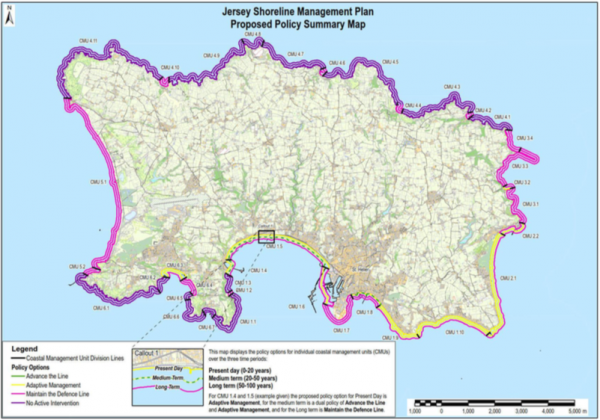
Pictured: The Shoreline Management Plan lays out a century-long plan to strengthen Jersey's sea defences.
For example, St Aubin's Harbour and parts of St Aubin's Bay were named as potential areas where sea defences may have to be repositioned between 2040 and 2070.
According to the UK National Oceanography Centre, ocean levels are set to rise by 83cm over the next 98 years – submerging huge areas of land.
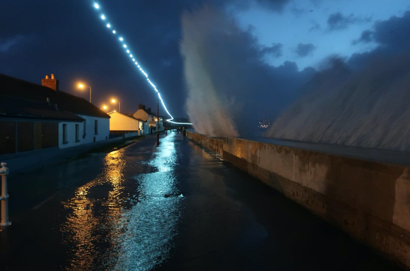
This comes as last week's high tide peaked at 12.32 metres – the second-highest tide ever recorded in Jersey.
Before the flood: the plan to protect Jersey from rising sea levels
£200m to be spent on sea defences over next century


Comments
Comments on this story express the views of the commentator only, not Bailiwick Publishing. We are unable to guarantee the accuracy of any of those comments.