Select a region


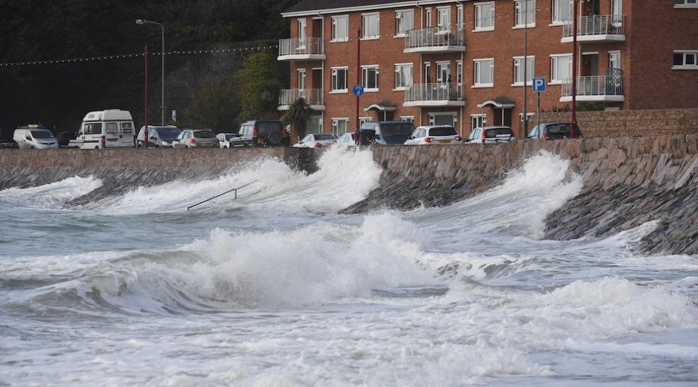

Storm Ciarán may be even worse than initially expected – with weather experts now forecasting that Jersey will be thrashed with "violent" winds of "just below hurricane force".
Issued shortly before 15:00 today, Jersey Met's latest weather warning predicts "violent storm force 11 [winds] with gusts to 90kt [103mph] later".
A red wind warning means storm force winds, and recommends that people "avoid outside activity" and "follow advice of authorities".
Wind Warning 2/11 issued 14:51 UTC Wednesday 01 November 2023 pic.twitter.com/LXHWNNPuev
— CI Weather Warnings (@Jersey_MetCI) November 1, 2023
The strongest winds are set to batter the island between 04:00 and 09:00 tomorrow morning.
Storm Ciarán has the potential to be as powerful as the Great Storm of 1987, although the wind direction this time – from the more prevailing south-southwest direction – may mean that trees are more suited to weather the strong gusts.
Giving an update on Wednesday lunchtime, Senior Meteorologist Manager Matt Winter said: “There will be exceptionally strong winds across the Channel Islands which we expect will bring significant disruption.
“We will start to feel the effects from 18:00 today with rain - heavy and persistent at times - arriving, with further bands following throughout the night. The wind will start to pick up from 21:00 onwards and will increase overnight, with the strongest winds expected between 04:00 and 09:00 tomorrow morning.”
Earlier today, Matt Winter, Senior Meteorologist Manager at @Jersey_Met gave us an update on #StormCiarán and how the system has been evolving.
— Government of Jersey (@GovJersey) November 1, 2023
As a reminder:
The main period of risk is from midnight until Thursday afternoon.
If you or someone else is in immediate danger call 999 pic.twitter.com/tqvN8fIePs
He added: “The low-pressure area will pass north of the Channel Islands but the strongest winds will be in the southwest flank of that low pressure, and that will be passing directly over Jersey between that 04:00 to 09:00 period.
“We have been looking at a lot of data and are pretty confident it will be Storm Force 10 coming from the west-southwest tomorrow morning, with occasional Violent Storm Force, which is just below Hurricane Force.
“The mean wind speed between 04:00 and 09:00 will be 65mph, with gusts of 90-95 mph. Having a mean wind speed of that strength is exceptionally rare for the Channel Islands.”

Pictured: Jersey Met Office's Senior Meteorologist Manager, Matt Winter. (Rob Currie)
Mr Winter said that the Storm Ciarán had the potential to be as strong as the memorable and highly disruptive one on 16 October 1987.
He said: “The low pressure system has a similar depth to it and the mean wind speed and gusts are of a similar strength.
“The difference is that the wind direction then was from a south to southeast direction, which meant that there was the potential for more damage.
“This time, the strongest winds will be coming from a west-south-westerly direction which is more usual; nevertheless, there is still the potential for significant disruption.
Mr Winter added: “It is important to say that, after 09:00 tomorrow, it does not mean that the winds will suddenly drop off. It will be a gradual process and there will remain Gale to Severe Gale Force winds throughout much of the day tomorrow.”
Forming off the east coast of North America, in the Nova Scotia area, Storm Ciarán is currently 500-600 miles west of France, moving towards the Channel Islands at a rapid rate.
Click HERE to follow Express's live updates...
We're keeping this page updated with live #StormCiarán updates as they come in, including...
— Bailiwick Express (@bailiwickxpress) November 1, 2023
???? Tide warnings
???? Bus timetables
⛔ Road closures
✉️ Mail updates
???? Supermarket stock
???? Bank closureshttps://t.co/ix57zESwwv


Comments
Comments on this story express the views of the commentator only, not Bailiwick Publishing. We are unable to guarantee the accuracy of any of those comments.