Select a region


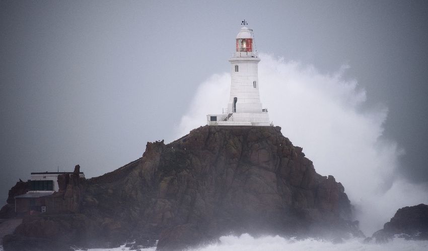

Jersey is at risk of experiencing a metrological phenomenon on Thursday morning which was responsible for causing extreme damage and disruption in the Great Storm of October 1987.
If a ‘sting jet’ passes over Jersey, it could intensify winds even more than the 90-95 mph gusts predicted between 4am and 9am tomorrow morning.
It is difficult to predict if a sting jet will arrive; not only is it difficult to model and primarily discernible using satellite imagery but also it is very narrow relative to the size of the storm – often just 30 miles across and only lasting three or four hours.
So, what is a sting jet and why could it feature over Jersey tomorrow?
According to the UK Met Office, a sting jet is small area of very intense winds – often 100 mph or more – that can sometimes form in powerful systems crossing the British Isles. It forms in rapidly deepening areas of low pressure and extends down towards the ground.
Warm air rises and cold air sinks, which create cloud and rain and also helps to form areas of low pressure, which sometimes form into storms. Weather fronts, which often sweep across Jersey, usually from the west, separate areas of warm and cold air, and it’s the interaction between the two which creates and develops wet and windy weather.
Close to these fronts there tends to be more focused streams of warm and cold air that run parallel to them, which are called 'conveyor belts'. These wrap around the low pressure and help to develop it by feeding warm air and moisture into the system.
Pictured: A guide to sting jets, produced by the UK Met Office.
A cold conveyor belt, which falls, brings moist, cold air from higher in the atmosphere down towards the centre of the storm. It can be cooled further because heat is removed by rain falling into it evaporating.
This causes the conveyor to cool even further, which causes the falling air to speed up even more. Denser than the surrounding air, the cooled air descends rapidly through the already intense storm, reaching the surface as a powerful and damaging sting jet.
The phenomenon gets its name due to its resemblance to a scorpion’s tail as it curls around the low pressure. They can be spotted as they develop on satellite images, where the end of the cold conveyor is marked by a hook-shaped cloud with a point at the end.
Sting jets only last three to four hours and cover a narrow area. This is because the cold conveyor catches up with itself after a few hours and consumes the sting jet. It means, therefore, that the sting jet could easily miss Jersey, if one does form. However, if it does pass over Jersey, it could amplify the wind strength battering the island.
Yes, it was a sting jet which made the Great Storm of 1987 so powerful and destructive. Indeed, it was studying why that storm had happened that helped to identify the phenomenon.
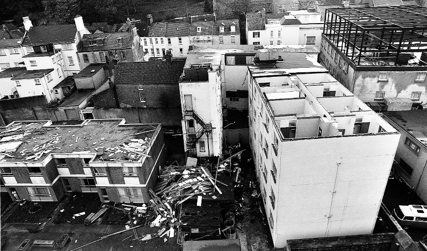
Pictured: The former Mayfair Hotel (right) after the Great Storm of 1987.
Matt Winter, Senior Meteorologist Manager at the Jersey Met Office, said that it was hard to classify whether a sting jet was present until the storm was fully formed.
“They are much easier to spot with satellite imagery although forward meteorological modelling is a lot better these days,” he said, adding that a sting jet had the potential to increase the winds even further if it passed above the Channel Islands.
It gets worse... Storm Ciarán now set to bring "violent" gusts of 100mph+
ADVICE: How should I prepare my home for Storm Ciarán?
Grands Vaux residents brace as Storm Ciarán approaches
◆ LIVE UPDATES: Storm Ciarán disruption
Hospital and airport set to close on Thursday
Schools to close on Thursday due to "significant" weather risks


Comments
Comments on this story express the views of the commentator only, not Bailiwick Publishing. We are unable to guarantee the accuracy of any of those comments.