Navigating Guernsey’s roads can be difficult at the best of times, with closures for everything from planned electricity grid upgrades to emergency gas leaks.
And after a heavy storm things can get even more treacherous, as branches, trees and – in some cases – even fallen walls block routes.
But one man has decided to make things a little easier for his fellow road users – by creating a mobile-friendly app.
Software developer Luke Jameson (28) said he got “frustrated trying to navigate around fallen trees and debris” after Storm Goretti hit last week.
“The official roadworks site was slow to load on mobile and difficult to use when I needed quick information.”
Faster and more practical
So, Mr Jameson – who lives in St Peter Port – set out to create a “faster, more practical” alternative that would work on his mobile phone.
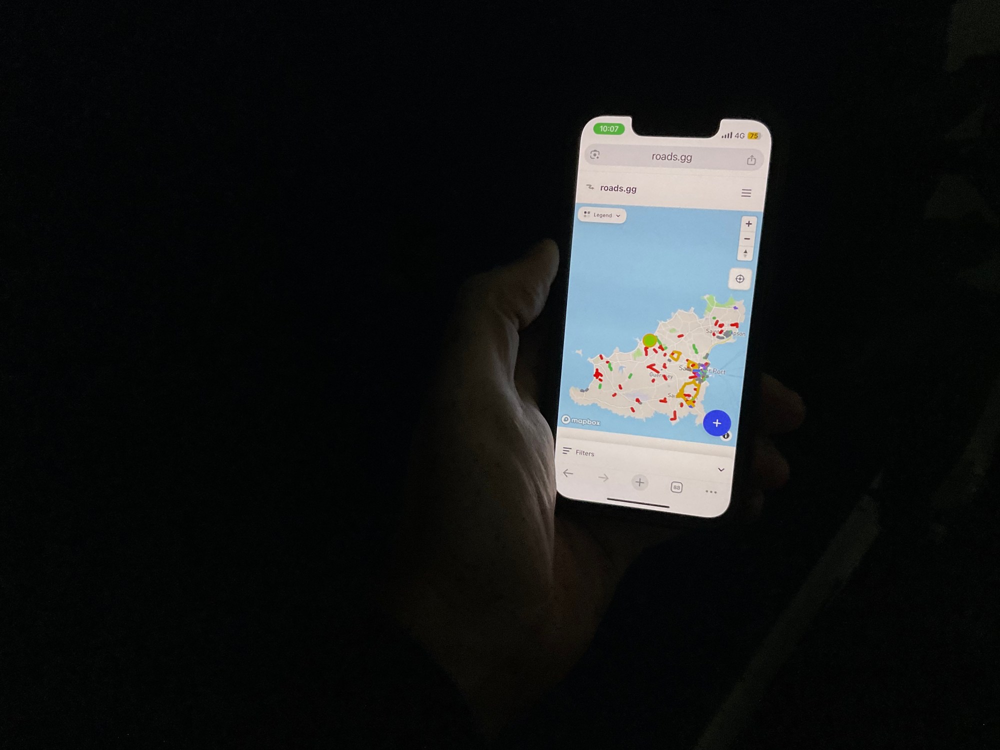
A week later the app – roads.gg – is not only up, but doing well with over 1,000 visitors and 3,000 hits on Facebook already.
The app uses data from the States, combined with community reporting to build an up-to-date picture of closures and diversions which works seamlessly on mobile phones.

Richer experience
Mr Jameson told Express he spent about two days developing the first version of the app, using a technology called SvelteKit.
He then spent another four days adding more polish and features – including ones suggested by users.
He said he wanted to “get the word out there so people start using it” as the community aspects of the app would become more useful as gained users.
“The more people are on the app, the more useful it’ll be,” he explained, “It’ll be a richer experience.”
Mr Jameson has previous created other apps for islanders in his own time, including seas.gg, which shows tide times for the Bathing Pools and around Guernsey.